
Iceland and the Scottish Highlands share the same moody atmosphere, the same low clouds dragging across volcanic rock, the same sense that the land is older and stranger than anything human hands built. But Iceland turns every Highlands trope up several notches, trading heather for lava moss, sea lochs for geothermal vents, and misty glens for ridgelines that look airlifted from another planet entirely. These ten places are the ones worth knowing for dramatic landscapes 2026, whether you are planning a shoot, a solo trip, or just building a deeply specific Pinterest board.
1. Landmannalaugar (and the Hrafntinnusker Obsidian Plateau)
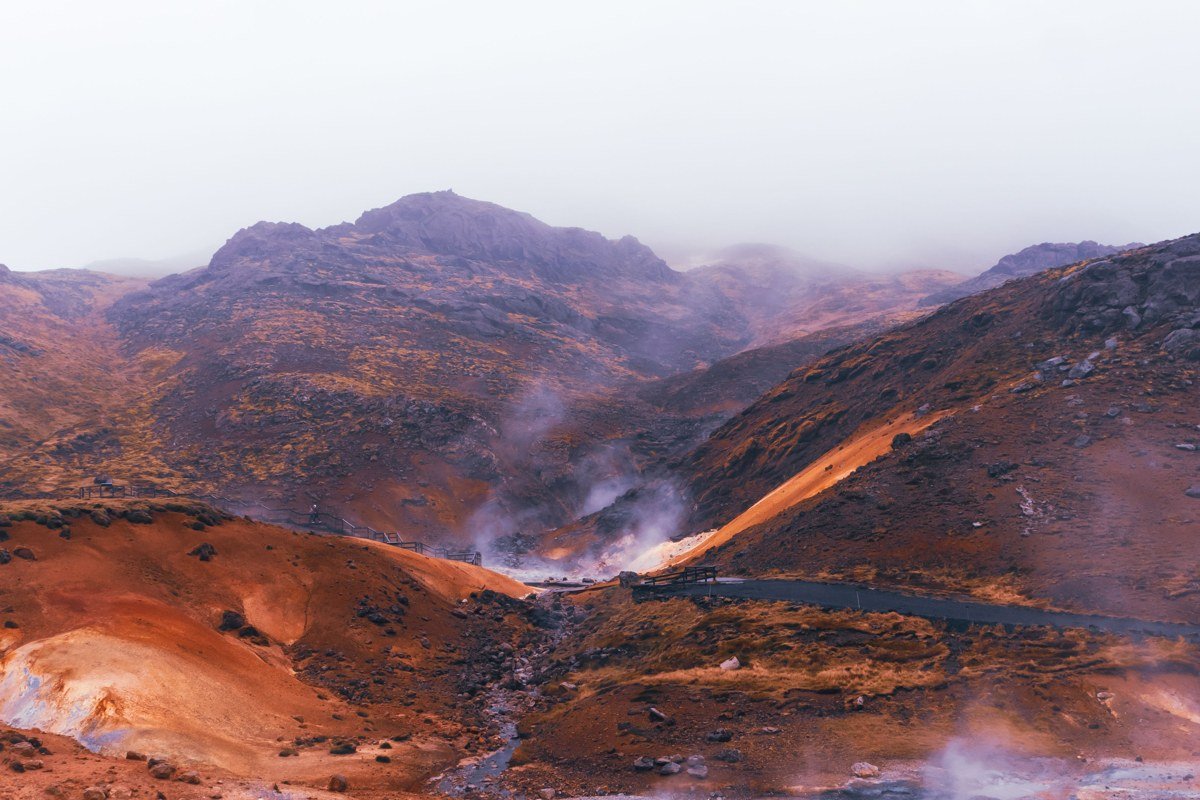
The rhyolite mountains here cycle through terracotta, sulphur yellow, dusty pink, and olive green, all in a single eyeful. This is the palette that makes Landmannalaugar the most photographed inland destination in Iceland, and no filter is needed or even helpful. The best thing to do is walk any section of the Laugavegur trail early in the morning before the highland buses arrive around midday, when the light is low and you genuinely have those striped peaks to yourself.
Best month within the window: Late August is the call. The main August rush has thinned out, the rhyolite colours are at their most saturated after a full summer of clear skies, and the F-road closure risk that starts creeping in through September has not yet arrived. July is busier and the hut queues show it.
The first day’s hike toward Hrafntinnusker introduces a sharp counterpoint to all that colour: a high plateau covered in obsidian, the jet-black volcanic glass that fractures into sharp, glittering shards underfoot. After the terracotta ridges of the valley floor, the sudden shift to pure black is genuinely disorienting in an atmospheric way. The trail also tends to hold snow late into summer, so micro-spikes in July are not an overreaction.
One honest trade-off: F-road access requires a four-wheel drive with decent clearance, and a river crossing is involved. Renting a basic compact and hoping for the best is not a strategy that will work out.
2. Eldhraun Lava Field
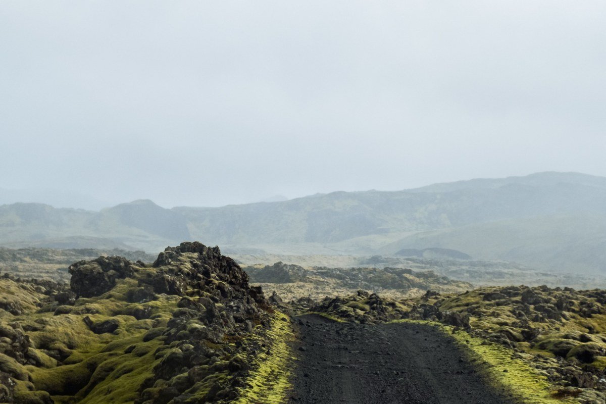
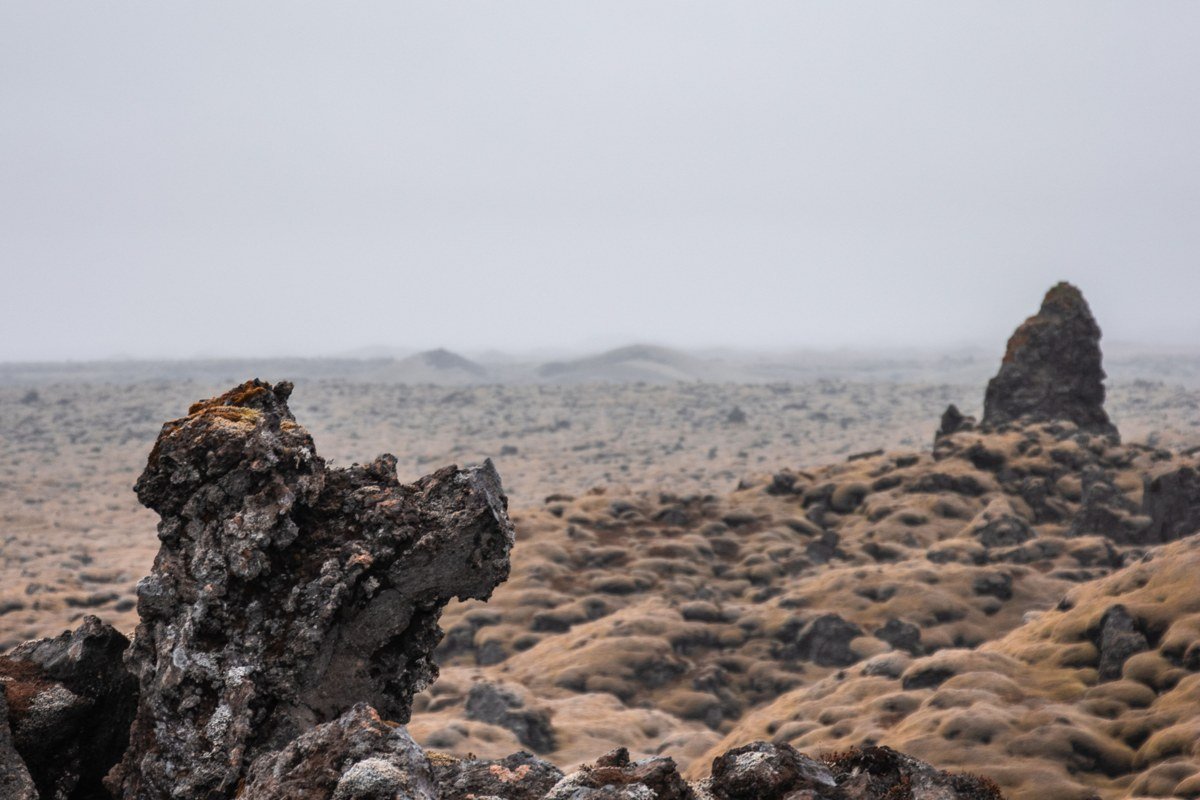
Eldhraun is the largest lava flow in recorded human history, produced by the Laki eruption in 1783, and every inch of it is now carpeted in a continuous, impossibly thick layer of woolly moss. Walking on it is forbidden, and the rule exists for good reason: the moss crust looks solid but conceals air pockets that collapse underfoot, and recovery takes decades. The correct move is to stop along the Ring Road near Kirkjubaejarklaustur, step off the gravel shoulder, and simply stand at the edge in the early morning mist, because that is when the fog sits just above the moss layer and makes the whole field look like a breathing thing. It gives the Scottish Highlands’ blanket bog energy but multiplied by a factor that is genuinely unsettling in the best way.
3. Vestrahorn and Stokksnes
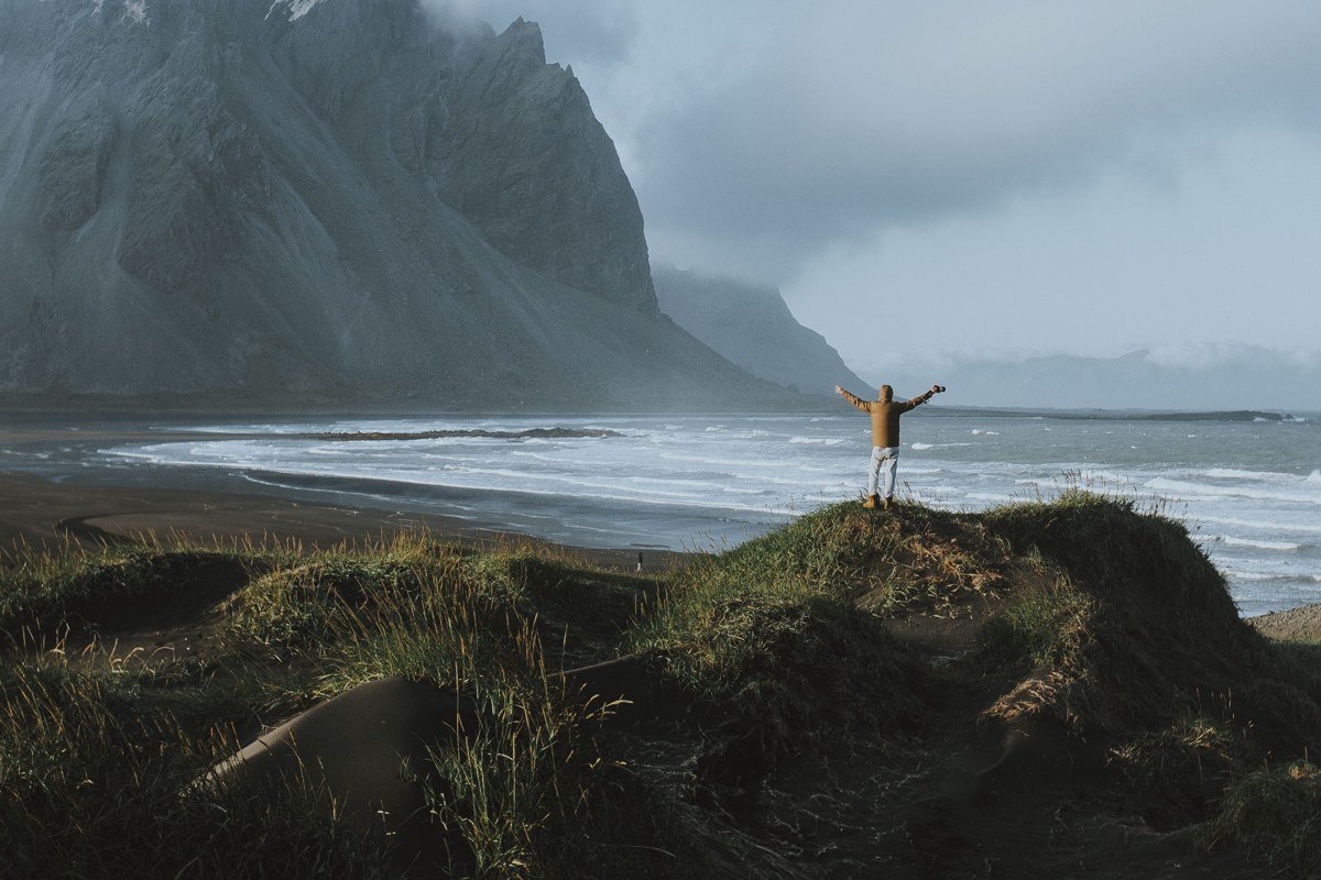
Vestrahorn is a gabbro and norite peak that juts out of the Stokksnes peninsula with zero visual warning, rising sharply over a black sand beach with small dunes that shift with every tide. The reflection shots, where the peak doubles itself in a thin sheet of tidal water across the sand, have circulated widely on Pinterest. For good reason: the vertical framing that works best on the platform lines up naturally here because the mountain is tall and narrow, and a portrait-orientation shot taken at ankle height captures both the peak and its reflection without any cropping compromise. The mountain genuinely earns the drama even when you have seen the images a hundred times.
Access requires a small fee paid at the Viking Cafe at the entrance to the peninsula, which is a straightforward arrangement and worth every króna. Come during the golden hour before sunset in late summer, when the light hits the north face of the mountain and the sand goes from black to deep copper.
4. Kerlingarfjoll
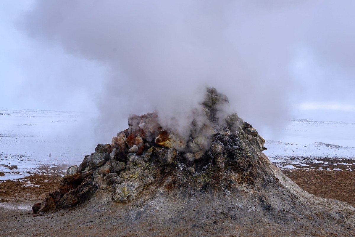
Less visited than Landmannalaugar but arguably stranger, Kerlingarfjoll sits in the dead centre of the island and combines rhyolite ridges with active geothermal fields where steam pushes out of orange and cream-coloured soil at the base of snow-patched peaks. The colour contrast between rust-red earth, white steam, remaining summer snow, and a clear blue sky produces something that looks edited even when it is not.
Best month within the window: Late July through mid-August. The snowpack on the ridges has thinned enough to allow access to the upper trails, but enough lingers in sheltered gullies to keep the colour contrast sharp. By early September, the steam vents can be partially obscured by early autumn cloud sitting lower on the ridges.
The best hiking follows the marked trails through the geothermal valley floor, where the ground is warm underfoot and the smell of sulphur is present but not overwhelming. Accommodation exists on-site at the mountain huts, which makes an overnight stay possible and allows you to catch the ridges in evening light after day visitors have left.
5. Fjadrargljufur Canyon
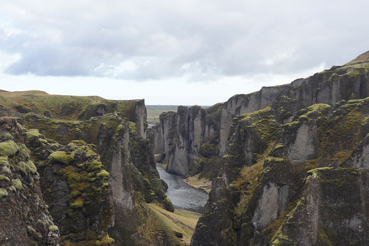
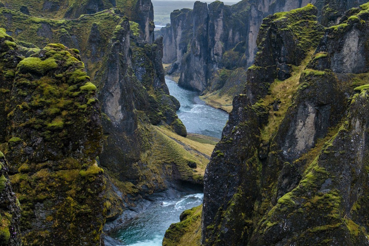
Fjadrargljufur is a narrow, two-kilometre canyon carved by glacial meltwater, and its walls are layered basalt draped in a green so saturated it reads as artificial. The canyon floor holds a pale glacial river that winds in loops visible from the rim viewpoints above, and the combination of geometric rock strata and vivid colour is the closest Iceland gets to something that feels like a Scottish glen rather than a Martian surface.
It is worth knowing the site’s recent history before you visit. Fjadrargljufur was temporarily closed after a surge in visitor numbers caused serious erosion damage to the rim and surrounding vegetation. It has since reopened, but access is now defined by a specific marked path along the rim, and stepping off that path is not permitted. The restriction is a direct consequence of the damage, and the defined route is not bureaucratic overcaution. Go early in the day before the tour buses arrive from the Ring Road. If you visit after rain, the moss doubles its intensity and the whole canyon steams faintly.
6. Snaefellsnes Peninsula
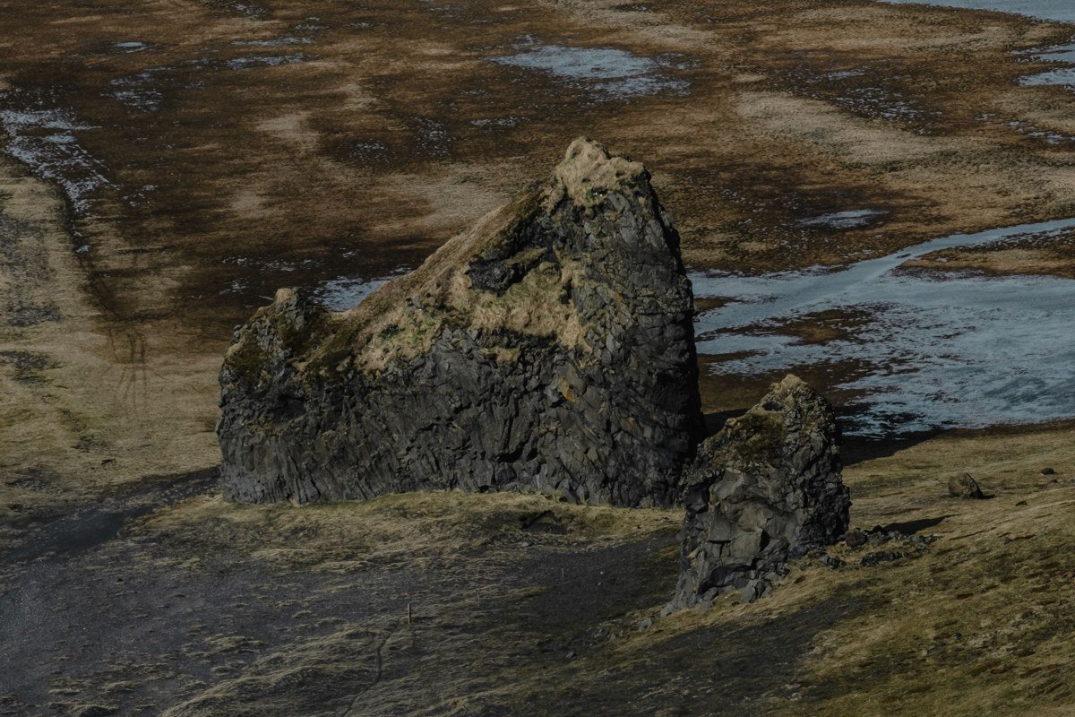
Snaefellsnes compresses an unreasonable variety of landscape into a single peninsula: a glacier-capped stratovolcano, basalt sea stacks, lava tube caves, and fishing villages ringed by angular peaks. Standing at the base of the glacier, Snaefellsjokull, with its ice cap sitting above the cloud line and the black lava flows spreading outward from its base, makes a strong case for the peninsula being the single most varied stretch of coastline in Iceland.
Two details worth knowing that most itineraries skip. First, the Saxholl crater on the northern side of the peninsula involves a short, steep climb up a chain-assisted path to a perfectly preserved volcanic rim. The walk takes fifteen minutes and the view across the Snaefellsnes lava fields from the top is wide and unobstructed. Second, the Londrangar basalt stacks at the western end of the peninsula change character completely depending on time of day. Morning light from the east catches the eastern face of the taller stack and renders the columnar jointing in high relief. By afternoon, both stacks are in shadow against a bright western sky, which produces a darker, more graphic silhouette and a completely different mood. Both versions are worth shooting.
A full day circuit of the peninsula from Borgarnes is realistic. If you only have a half day, prioritize the western end, the glacier approach, and the Saxholl crater walk.
7. Thorsmork and Godaland
Thorsmork sits at the southern terminus of the Laugavegur trail, enclosed by three glaciers, and it does not look like the rest of Iceland. A rare area of sheltered birch woodland grows in the valley floor, protected from the wind by the surrounding ridges and moraines, and the combination of actual trees, glacier tongues, and deeply eroded canyon walls is unlike anything else on the island. The Godaland area immediately to the east extends this strangeness: the Krossarjokull glacier’s lateral moraines have left a landscape of ridges, hollows, and exposed glacial sediment in colours that run from grey to deep ochre.
Best month within the window: Late August. The birch leaves are beginning to turn, which adds a warm yellow note to the grey-green palette of the valley, and the Laugavegur through-hikers have thinned out after the peak July and early August rush.
Access to Thorsmork requires a four-wheel-drive vehicle capable of fording several glacial rivers, or a seat on one of the dedicated bus services that run from Reykjavik and Skogar during summer. Day trips are possible but an overnight stay at one of the valley huts gives you the evening and morning light, which is when the glacier faces glow and the woodland feels genuinely atmospheric.
8. Askja Caldera
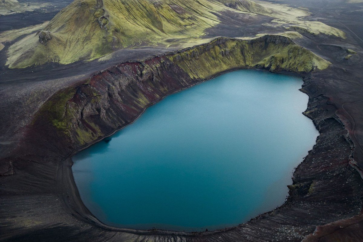
Askja sits in the Icelandic highlands behind a long F-road that crosses a lava desert, and arriving there after that drive makes the payoff feel proportional. The main caldera holds Oskjuvatn, a deep, cold lake, and adjacent to it is Viti, a smaller explosion crater containing geothermally warmed water in a vivid turquoise. NASA used the surrounding terrain to train Apollo astronauts before the moon landings, and the landscape supports that association entirely.
Swimming in Viti is possible and worth doing, though the entry down the steep crater wall requires care. This is a full-day commitment from the nearest accommodation and is typically only accessible between late June and early September.
9. Djupivogur and the Berufjordur Fjord Coast
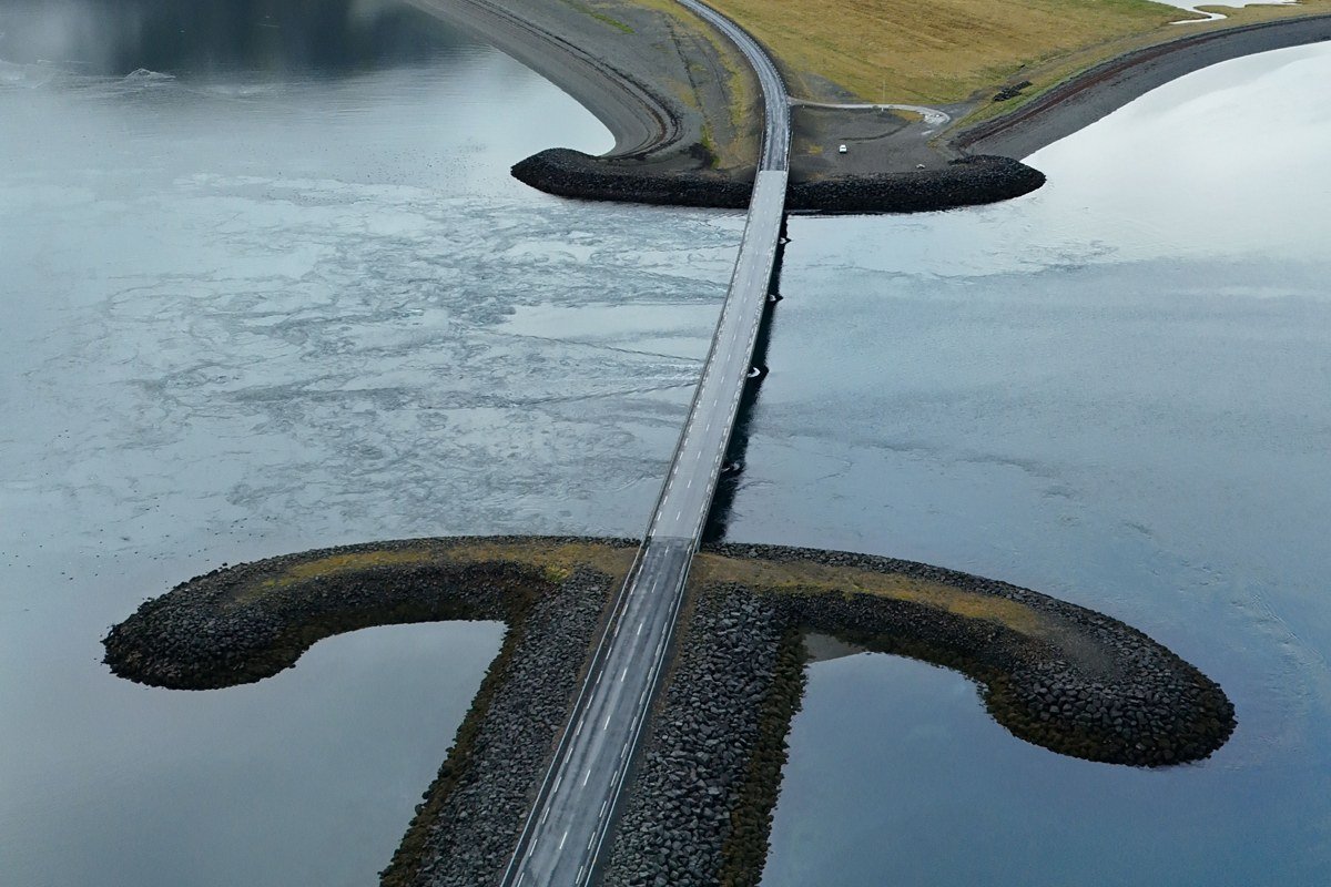
East Iceland is significantly less visited than the south or west, and the fjord landscape around Djupivogur has a quieter, more austere quality that reads closer to the Scottish Highlands than anywhere else on this list. The mountains here are older and more heavily eroded, and the fjords are long and narrow with calm water that reflects the peaks above on windless mornings.
The small town of Djupivogur has a waterfront sculpture installation called Eggs of Merry Bay, created by Icelandic artist Sigurdur Gudmundsson. The installation comprises 34 large granite eggs, each one representing a bird species that breeds in the Berufjordur area. As a foreground element for fjord photography the eggs are unusual and specific in a way that generic driftwood or fishing boats are not, and knowing what they represent changes how they read in an image.
The East Fjords in general are the part of Iceland where you are genuinely unlikely to encounter a crowd even in peak season, which has its own distinct appeal.
10. Reykjanes Peninsula Lava Fields
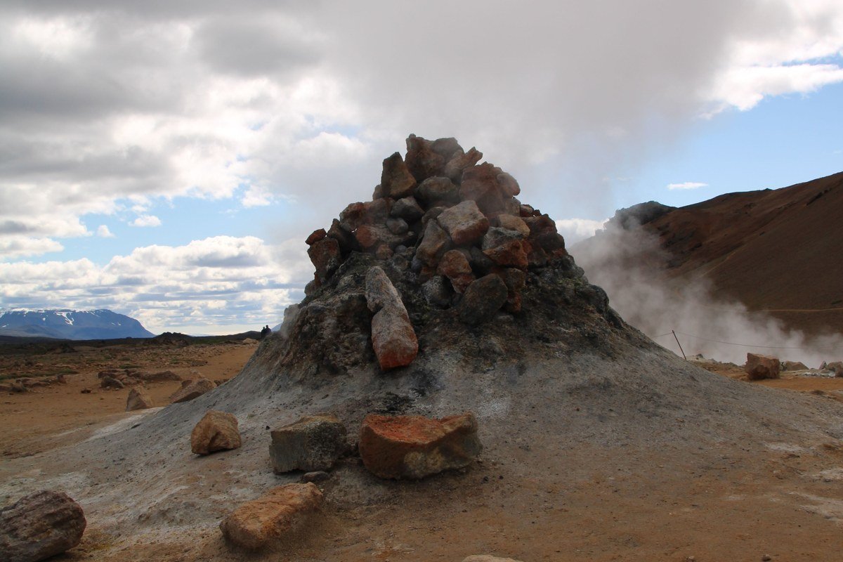
The Reykjanes Peninsula has been erupting on and off since 2021, making it the most actively dramatic landscape on this list in the most literal sense. The eruption sites near Grindavik have produced fresh lava flows that are still cooling, and walking alongside fields of cracked, steaming black rock with solidified lava channels visible in cross-section is something no other easily accessible location in Europe offers. The colour palette here is almost entirely monochrome: black rock, white steam, grey sky, and occasionally a vivid orange glow if activity is ongoing.
Access depends entirely on current volcanic activity and official safety guidance. Checking updates through the Icelandic Meteorological Office before visiting is not optional. When it is open, this is the single strangest and most immediate piece of terrain on the peninsula, forty minutes from Reykjavik by car.
Practical Takeaway
Iceland rewards timing and logistics more than almost any other destination. The window between late June and early September gives you reliable road access to the highland interior (Landmannalaugar, Kerlingarfjoll, and Askja all require F-roads that close in winter), long golden hours in morning and evening, and reasonable weather odds. For the specific highland destinations, late August is the most useful target: crowds from the peak July rush have dropped, the rhyolite and geothermal colour contrasts are at their richest, and the F-road closure risk that arrives with September weather has not yet made planning unreliable. This is the level of timing specificity that separates a usable trip plan from a generic seasonal window.
Rent a proper four-wheel-drive vehicle if the highland roads or Thorsmork river crossings are on your itinerary. Book mountain huts on the Laugavegur trail through the Icelandic Touring Association the moment bookings open, usually in winter for the following summer. Pack waterproof layers regardless of the forecast, because conditions shift within a single hour across most of these locations. Budget time in the East Fjords even if they are not the headline item: the lack of crowds and the quality of light in that quieter terrain is consistently the detail that serious landscape photographers mention first when they compare notes on an Iceland trip.