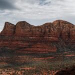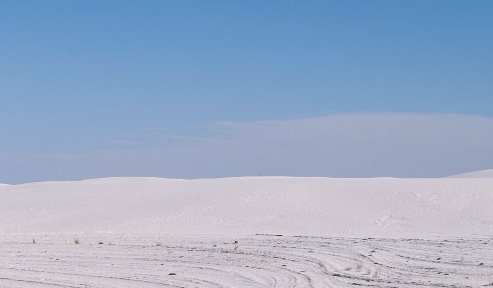

The mistake almost everyone makes is treating Death Valley, California and White Sands, New Mexico as two separate bucket-list trips instead of one long desert line worth driving in a single go. People fly to Las Vegas, Nevada for one and to El Paso, Texas for the other, and they miss the fact that the country in between, southern Arizona and southwestern New Mexico, is some of the strangest and least-photographed ground in the American desert. This guide covers the corridor in three tiers, three anchor parks, four worth-the-drive detours, and two stops that take real planning, so you can build a trip that fits a long weekend or a proper two-week haul.
The route at a glance
| Stop | Off-route detour | Time needed | Entrance/permit fee |
|---|---|---|---|
| Death Valley NP, CA | On route | 2-3 hours | $30 per vehicle, 7-day pass |
| White Sands NP, NM | On route | 2-3 hours | $25 per vehicle, 7-day pass |
| Organ Mountains-Desert Peaks NM, NM | On route | Half day | Free, $5 self-pay at some trailheads |
| City of Rocks SP, NM | 25 miles off US 180 | 2-4 hours, or overnight | $5 day use, $14 basic campsite |
| Gila Wilderness/Cliff Dwellings, NM | 2.5 hours from Las Cruces | Half day minimum | $10 per person cliff dwellings; free self-issue permit for overnight backcountry travel |
| Rockhound SP, NM | 20 minutes off I-10 | 1-2 hours | $5 day use |
| Valley of Fires, NM | 15 minutes off US 380 | 30-45 minutes | $5 day use |
| Chiricahua NM, AZ | 1.5 hours south of I-10 | Half day | $10 per vehicle, 7-day pass |
| Guadalupe Mountains NP, TX | 2 hours from El Paso | Full day | $10 per person, 7-day pass |
A minimum version (the three anchors only) is a long weekend. Add two or three detours and it’s five to seven days. All nine stops, with real time to hike and camp, is closer to two weeks.
The three anchors

These are the parks the route is named for and built around. You could do just these three and still have a real trip.
Death Valley National Park, California
Badwater Basin, the salt flats sitting below sea level, and Zabriskie Point’s badlands are both roadside-accessible, no hiking required. The park is roughly a two-hour drive from Las Vegas, which makes it the easiest true desert extreme in the country to reach on a weekend. Entrance is $30 per vehicle, good for seven days.
Summer here is not just hot, it is dangerous-hot, with car troubles turning serious fast. Aim for November through March and pack more water than feels necessary. Effort: 2 hours from Las Vegas, most highlights are drive-up viewpoints.
White Sands National Park, New Mexico
The gypsum dunes look like snow and photograph like nowhere else in the country, and unlike Death Valley, this park is pleasant to visit most of the year. It sits about an hour from Las Cruces, New Mexico, itself roughly 45 minutes north of El Paso, Texas. Entrance is $25 per vehicle for seven days. Plastic saucers for sledding the dunes are sold at the visitor center for around $20, plus a small wax fee if you want your saucer to actually slide (it’s worth it, dry sand alone barely moves).
Check the park’s schedule before you go: the road periodically closes for a few hours at a time for missile testing on the adjacent range, since White Sands shares a boundary with White Sands Missile Range. Effort: 1 hour from Las Cruces, flat walking on marked trails.
Organ Mountains-Desert Peaks National Monument, New Mexico
The jagged granite spires rise right behind Las Cruces, and the Dripping Springs trail into the foothills is a short, well-marked out-and-back most people can do before lunch. It’s a good hiking base for this whole region, alongside the Gila Wilderness further west. Entry is free, though some trailheads have a $5 self-pay day-use fee.
Most visitors treat Las Cruces as a gas-and-go stop between El Paso and White Sands. It deserves a night. Effort: 20 minutes from Las Cruces, 1.5 to 3 hour hike depending on trail choice.
Worth the drive
These require a real detour off the direct Death Valley to White Sands line, adding half a day to a full day.
City of Rocks State Park, New Mexico
Volcanic rock formations rise out of flat grassland off NM 61 south of Silver City, New Mexico, similar in feel to Chiricahua National Monument in Arizona but smaller, quieter, and free of crowds. You can walk directly into the rock maze with no permit and no crowd control. Day use is $5 per vehicle. The campground has basic sites for $14 a night (no hookups, pit toilets, some sites tucked directly between the rock formations) and Campsite 12 is the one to request if it’s open, it backs right up to a formation with no neighbors on one side.
Most road trippers have never heard of it because it sits off the interstate corridor entirely, reached via smaller state highways rather than I-10 or I-25. Effort: roughly 25 miles off US 180, 1-2 hours to explore on foot, or overnight.
Gila Wilderness, New Mexico
The country’s first designated wilderness area is a genuine outlier in a desert road trip: canyons, pine forest, and hot springs instead of sand and salt flats. The cliff dwellings inside Gila Cliff Dwellings National Monument cost $10 per person and are the draw for most people, but the backcountry beyond them is where the wilderness earns its name. If you’re heading past the trailhead into the wilderness itself, there’s no fee, but you do need to fill out a free self-issue permit at the trailhead register, standard backcountry practice but easy to skip if you don’t know to look for it.
Access is via Silver City, which also has the only regional airport in southwest New Mexico, though service is limited to a handful of commuter flights. One practical warning: gas stations thin out fast between Silver City and Deming, so fill up in Silver City before you head south, don’t count on finding an open pump along the way.
The access road, NM 15, is narrow and switchbacked. Anyone towing anything or driving a full-size RV should route around via SR 152 instead, which has its own hairpin curves but handles bigger vehicles better. Effort: 2.5 hours from Las Cruces, half-day minimum for cliff dwellings and a short trail.
Rockhound State Park, New Mexico
This is a state park that lets, even encourages, visitors to take rocks home. Perlite, geodes, and quartz crystals are scattered across the hillsides near Deming, New Mexico, and there’s no ranger checking your pockets on the way out. Day use runs $5 per vehicle. It’s a strange, satisfying contrast to every other stop on this list where the rule is look, don’t touch.
Summer here is brutal, hotter and more exposed than Death Valley’s overlooks, so treat this as a fall-through-spring stop only. Effort: 20 minutes off I-10 near Deming, 1-2 hours of scrambling and searching.
Valley of Fires Recreation Area, New Mexico
A black lava flow, one of the youngest in the continental US, cuts across the desert near Carrizozo, New Mexico, on the more direct route between the Gila region and White Sands. Day use is $5 per vehicle. The paved nature trail loops through the flow itself, close enough to touch the rock, a genuinely different texture than the gypsum dunes waiting an hour or so east.
Almost nobody stops here on the drive to White Sands, which is the point of this whole route: the icon and the overlooked stop are close enough to hit both. Effort: 15 minutes off US 380, 30-45 minute walk.
Earn it (long haul, big payoff)

These take real planning, either a permit, a long unpaved stretch, or a schedule that doesn’t forgive a wrong turn. Save them for a second or third trip through the region, once you know the roads.
Chiricahua National Monument, Arizona
The “Wonderland of Rocks” in southeastern Arizona is the formation City of Rocks in New Mexico echoes on a smaller scale. Entrance is $10 per vehicle for seven days. Echo Canyon Loop trail winds through towering rhyolite spires and narrow passages that feel closer to a slot canyon than a standard desert hike. It sits far enough from the interstate that most Southwest itineraries cut it entirely.
This is a genuine detour south off I-10 near Willcox, Arizona, not a quick stop, so budget it as its own half-day rather than a drive-by. Effort: 1.5 hours south of I-10, 3 hour loop hike.
Guadalupe Mountains National Park, Texas
Guadalupe Peak, the highest point in Texas, sits inside this park east of El Paso, and it’s the hardest single hike on this list: a full-day climb with real elevation gain and no water sources along the trail. Entrance is $10 per person for seven days. It pairs naturally with White Sands since both sit on the eastern end of this loop, close enough to combine into one long weekend if you’re willing to hike hard one day and walk dunes the next. Salt Basin Dunes, a lesser-known white dune field inside the same park, is the quiet alternative if the peak feels like too much.
Trail conditions and wind exposure near the summit change fast, and there’s no shade or reliable cell signal on the way up. Effort: 2 hours from El Paso, 8-9 hour round trip hike to the summit.
If your first pass through this loop only covers the three anchors, the natural next trip is to add one detour stop and one earn-it stop rather than trying to do all nine at once. The desert Southwest rewards slowness. A night at City of Rocks or a full day on Guadalupe Peak will teach you more about this landscape than another hour on I-10 ever will.